Marina Spindel, an international Masters student from the IMAE program, joined the University’s Centre for Applied Conservation Science (CACS) on a collaborative project with the non-profit organisation Conservation International (CI). The Trial by Fire project explores potential fire management strategies for the protection of revegetation sites across the Tonle Sap and broader floodplains.
Known as “Cambodia’s beating heart”, the Tonle Sap Lake plays an important social, environmental and economical role to the region. Nationally fish catch contributes 70% of the animal protein intake of the entire Cambodian population making lake fisheries not only important to the local communities, but for the whole country. However, during the dry period (November to April), the Tonle Sap Lake reduces to a sixth of its size with fire posing an imminent danger to the exposed floodplains vegetation. In 2016, an El Niño event prompted significant fires that burned nearly 250,000 hectares of flooded forest around the Lake, representing a loss of one third of floodplain vegetation.
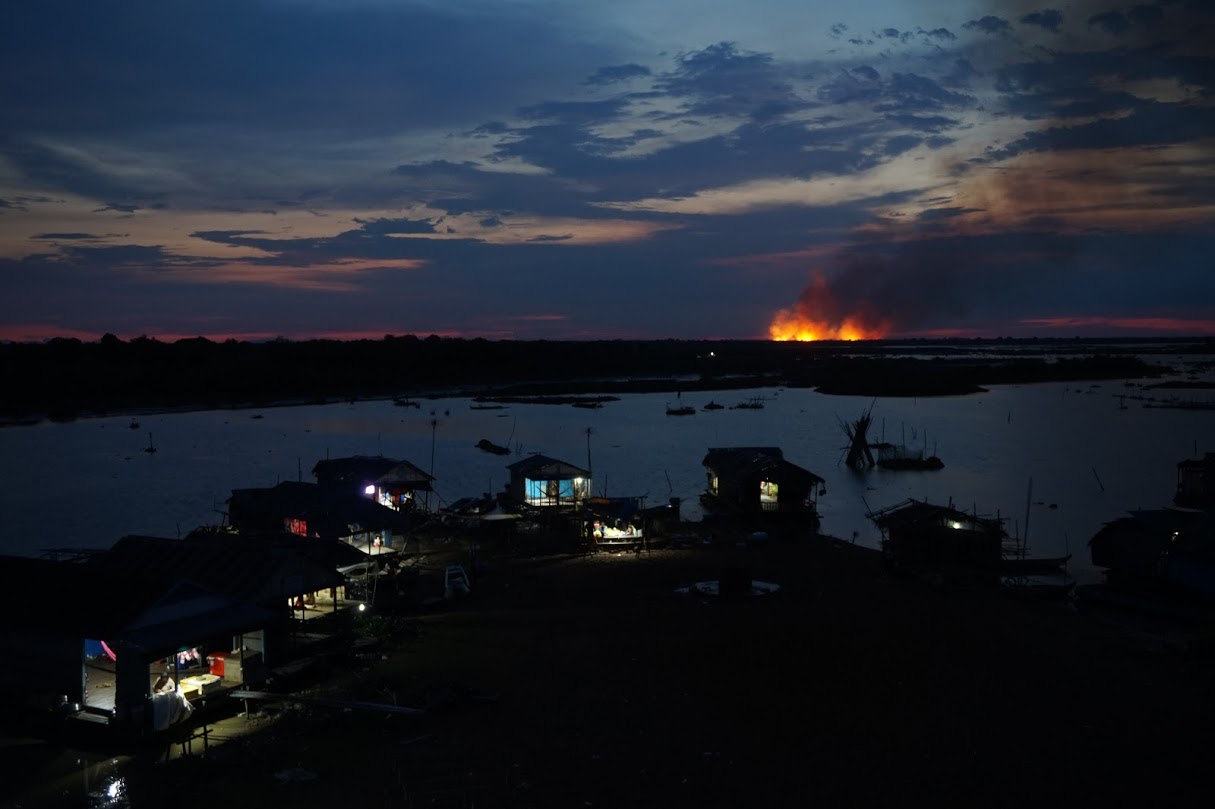
Behind the Village of Akol, fire burns unmanaged in the Tonle Sap’s floodplain. Photo credit Ramesh Raja Segaran
The loss of this vegetative habitat has had significant repercussions for local fisheries which support over one million people. In recent years, local CI programs have conducted revegetation over 160 hectares in the region to assist in minimising the impacts of such fires to future livelihoods. However, despite these efforts, fire remains a prominent and growing risk.
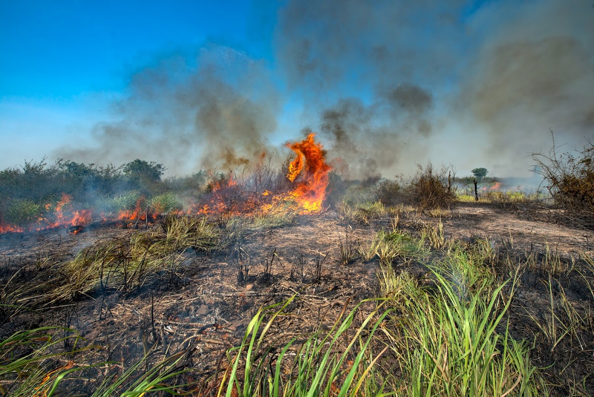
Fire burning valuable floodplain vegetation in the Tonle Sap. Photo credit James Trezise
In late April 2019, Marina was joined by Unmanned Research Aircraft Facility Director, Ramesh Raja Segaran, and fire ecologist and PhD student, James Trezise on a trip to Cambodia, where the team worked alongside the local communities and CI to gather landscape data using drone technology. The team set out to assess the potential for fire management around the proposed revegetation sites using drone surveys and spatial imagery analyses. Drone mapping was conducted at four sites with an aim to identify opportunities for natural resource fire management and assist in the strategic positioning of new revegetation sites.
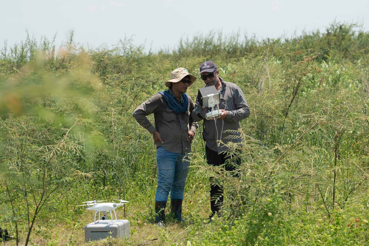
Dr Ramesh Raja Segaran and Vises Ung, CI Spatial Analysis Coordinator, get ready to fly the drone used to map one of the proposed revegetation sites. Photo credit James Trezise)

Community members along with CI staff and University of Adelaide team participate in a community mapping exercise in order to identify spatial opportunity’s for fire management in the landscape. Photo credit James Trezise
The trip also enabled the team to work with local groups to fill in the lack of broader information on fire management across the region. Marina, Ramesh and James worked with the local CI team to establish a series of workshops with federal and provincial government officials and community leaders. These workshops served to exchange knowledge and gain a deeper understanding of the fire management context and capabilities within the communities. From these discussions, it was found that a holistic approach of the situation was required in order to create effective solutions.
In the coming months recommendations for a fire management plan will be finalised, based on the discussions and data collated from this trip.
This research was possible thanks to the financing from the Toyota Environmental Activities Grant Program. Click for more information on the project.
This report / blog post was made with support from Toyota Environmental Activities Program of Toyota Motor Corporation.
Post written by Nadia Meakin.