The remote sensing work of University of Adelaide PhD candidate W. Boone Law has recently been selected for the 2020 May/June cover of Geoarcheaology.
Geoarchaeology is an international journal dedicated to original interdisciplinary scientific research where geographical, geological, geophysical and Earth science techniques are used to better understand the archaeological record.
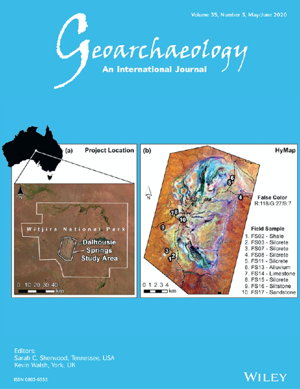
(Pictured right: The front cover of the 2020 May/June edition of Geoarchaeology featuring the hyperspectral remote sensing research of candidate W. Boone Law.)
Boone’s research is possibly the first Australian study to be featured on the cover of the journal, which has been in publication since 1986. The article, co-authored with Professor Megan Lewis (University of Adelaide), Associate Professor Bertram Ostendorf (University of Adelaide), and Professor Peter Hiscock (University of Sydney), shows how aerial hyperspectral imagery can be used to identify surficial deposits of silcrete, an economically important rock used by Aboriginal peoples to manufacture stone artefacts.
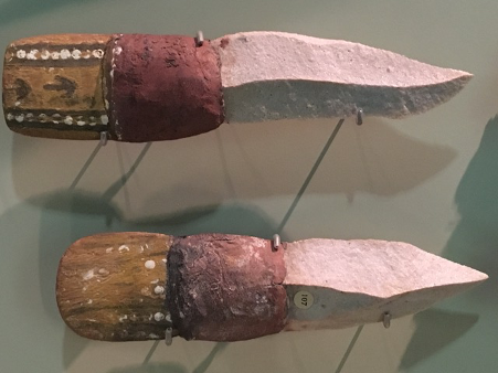
Silcrete stone knives collected from the northern Lake Eyre region of South Australia, on display at the South Australia Museum.
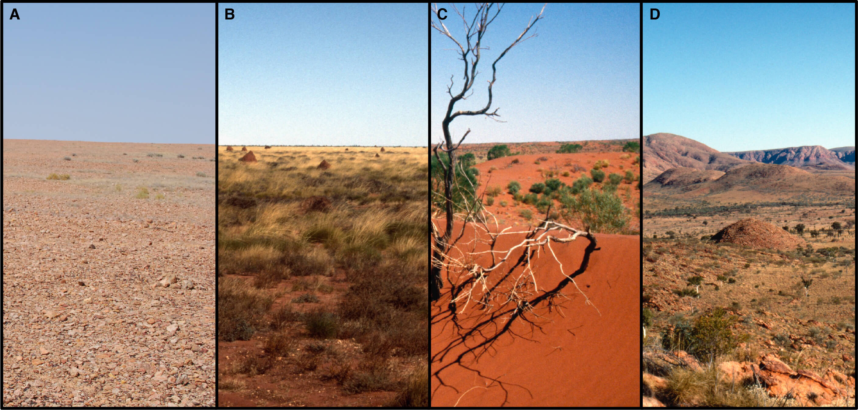
In many parts of central Australia, silcrete is the principal raw material identified in artefact assemblages, and it was used to make a wide range of stone tools. For example, a visit to the Aboriginal Cultures Gallery at the South Australian Museum, is a likely place to observe silcrete stone artefacts in many of the museum’s public displays. For the Indigenous peoples of far north South Australia, silcrete was an import commodity for their technological and socioeconomic system. Thus, one of the outcomes of this research may be to map the abundance and distribution of this resource in arid outback regions of Australia.
Identifying where lithic raw materials naturally occur is a topic of great interest for archaeologists. Researchers usually rely on geological maps, geomorphological land characteristics, artefact attributes, and conventional petrological characterizations to identify the origin of raw materials like silcrete. Pinpointing raw material sources is often a time‐consuming and labour‐intensive exercise, and frequently the precise location of the geological resource cannot be identified.
The method Boone used to identify surface silcrete sources is novel compared to these other approaches, being entirely based on hyperspectral remote sensing. This form of optical remote sensing records the reflectance of Earth surface materials in parts of the electromagnetic spectrum from the visible into the shortwave infrared (SWIR). Using aerial hyperspectral imagery, he was able to identify hydrated silica‐bearing rocks like silcrete via a unique spectral feature in the SWIR. This distinctive ‘spectral signature’ enabled him to map surface silcrete sources in the Dalhousie Springs area of northern South Australia, demonstrating a how hyperspectral remote sensing can be an effective tool for identifying potential ‘tool stone’ resources.

Hyperspectral image analysis can target and reveal the distribution of Earth surface materials that not apparent in conventional true colour imagery (i.e., visible light), as seen above. The left image (a) is true colour aerial overview image of the Dalhousie Springs study area. The right image (b) is an analysed aerial hyperspectral image where a spectral fitting algorithm was used to identify pixels that match the shortwave infrared ‘spectral signature’ of hydrated silica-bearing rocks (red areas). Fieldwork confirmed the rocks to be silcrete.
This research illustrates how hyperspectral imagery can assist archaeological researchers by identifying where siliceous rock lithologies occur, but possibly the greatest benefit of this research lies in its potential to save time, money, and improve research outcomes. The study shows how desktop-based image analysis can assist researchers with the rapid production of highly accurate and targeted natural resource maps, diminishing the need for costly and time-consuming field reconnaissance.

During a field trip in central Australia, W. Boone Law photographs a silcrete outcrop.
Boone’s recently submitted PhD has been supported by the University of Adelaide Faculty of Sciences Divisional Scholarship and the Constance Fraser Supplementary Scholarship. The South Australian Department of Environment and Water and the Witjira National Park Co-management board provided scientific permits to access places in the Dalhousie Springs complex.
The authors also wish to acknowledge and pay respects to the Southern Arrente, Wangkangurru and Indigenous peoples of the Irrwanyere Aboriginal Corporation, as the Traditional Owners of the lands of this region. If any student is interested in the environmental remote sensing and spatial science program at the University of Adelaide, you may contact Professor Megan Lewis in the Faculty of Sciences for more information. Post by W. Boone Law.