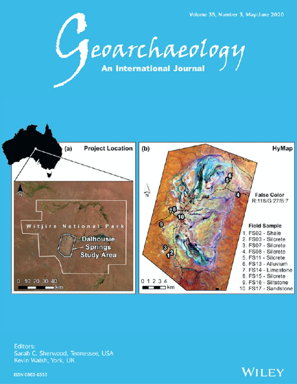
The ‘Western Desert’, as it is commonly known, is one of the most arid and geographically remote regions of Australia.
It expands across roughly 14.0% of the continent, encapsulating nearly 1.1 million km2 in total. Rainfall, which averages less than 250 mm annually, is seasonally unreliable and ambient temperatures exceed 35°C more than 114 days out of the year. The Western Desert has always presented severe challenges for human survival, yet despite its harsh conditions, Aboriginal peoples have maintained an enduring presence in the region for more than 45,000 years, continuously adapting to environmental variations through complex socioeconomic strategies.
Our research published in Scientific Reports, uses Earth Observation data to model the Western Desert environment in order to better understand the foraging challenges and opportunities confronting precontact desert peoples. Our model evaluates foraging habitat suitability based on the best environmental conditions of the past three decades, using satellite observations of maximal water abundance, vegetation greenness, and terrain ruggedness (Fig. 1).
We integrated this information with previous research into traditional subsistence and settlement practices, enabling researchers to estimate daily foraging range in proximity to water. In doing so, our model reveals much about the environmental diversity of the desert, enabling us to form hypotheses about the possible foraging habitats used by precontact Aboriginal peoples living in Australia’s Western Desert.

(Fig. 1) Image: W.Boone Law. University of Adelaide researchers used more than two decades of Earth Observation data to model foraging habitat suitability in the Western Desert, as informed by the best contemporary environmental conditons and previous research into traditional subsistence and settlement practices. The results offer radical new ecological and archaeological insights of the challenges and opportunities confronting precontact desert forager societies.
A Question of Analytical Scale
Previous models of human ecology in Australian deserts used coarse-scaled analytical approaches to characterise arid environments. These earlier models functioned under the assumption that ecological and environmental parameters are essentially linked to broad geographical units such as land systems and bioregions (Fig. 2).
These portrayals led to a view that predictable foraging behaviours could be attributed to such land units, so many researchers began evaluating the Aboriginal archaeological record using coarse-scaled biogeographic divisions of analysis. While practical, these heuristic approaches fostered a one-dimensional, coarse grained ecological understanding of the arid zone archaeological record, and our research demonstrates why this proposition is problematic and should be abandoned.
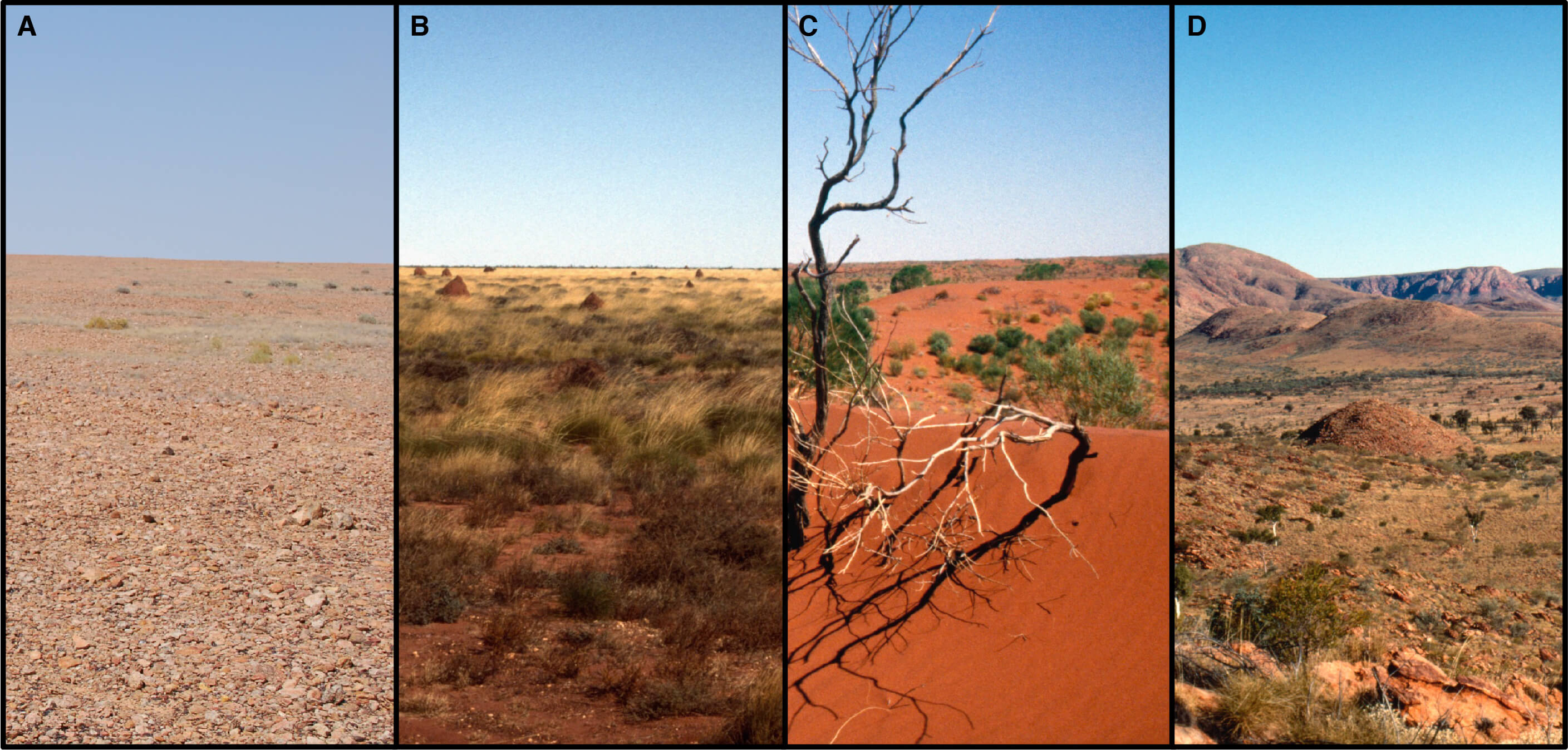
(Fig. 2) Image: W. Boone Law. Land systems of the Western Desert include (A) stony plains, (B) sand plains, (C) sandridge desert and (D) montane desert uplands. These coarse-scale geographical units feature prominently in past ecological and archaeological models of precontact Aboriginal land use. Recent satellite modelling depicts the highly varied suitability of foraging habitats within these arid land systems.
The fine scale of our satellite model depicts the highly varied nature of suitable foraging habitats, at ~30m pixel resolution, across all land systems and bioregions of the Western Desert. The model shows that extremely unsuitable foraging habitats and very well-suited foraging areas can potentially occur in any area of desert, regardless of land systems or other biogeographical characteristics. For example, sandridge deserts were once believed to have periodic barriers for past occupation, but our model shows some interdunal swale areas can offer favorable foraging habitats in times of water abundance (Fig. 3).
However, there is also a high degree of variability in sandridge systems, and high-ranked favourable habitats are not pervasive across all dunefields (Fig. 3). Some sandridge desert areas are likely to be unfavourable to foraging activities, as previously suggested. Thus, our research illustrates how environmental conditions and suitable foraging habitats can vary greatly amongst ostensibly similar landscapes.
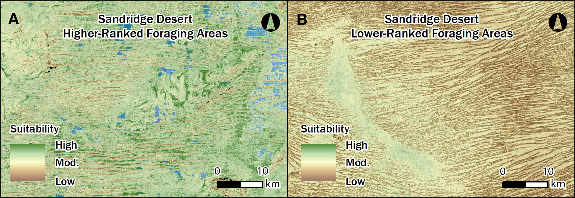
(Fig. 3) Image: W. Boone Law. An example of varying habitat suitability in sandridge desert landscapes. (A) Some interdunal swale areas may be rich with water and plant resources with high-ranked foraging suitability during good environmental conditions. In contrast, (B) some dunefields remain resource poor habitats throughout time.
Habitat Suitability Infers Resource Distribution and Land Use
Visualising how foraging habitat suitability varies across the Western Desert is important for understanding the late Holocene archaeological record of the past 2000 years, when climatic conditions and landscapes were much like the present day. Previous ethnographic research has noted that the historic desert peoples were extremely familiar with the distribution of regional natural resources. It has been argued that resource knowledge was articulated with socioeconomic strategies, and that groups routinely utilized all areas of the Western Desert during times of good rainfall and resource abundance. Although, our model reveals that there are large, expansive areas of the desert landscape that would have always presented substantial challenges for survival (see Fig 1).
We suggest that some low-ranked areas of habitat suitability were resource-poor and not economically attractive to foraging activities, even in the best environmental circumstances. However, unlike earlier research, our suitability model shows that unfavorable foraging areas are not correlated with particular land systems or biogeographic units. We hypothesise that the distribution of sizeable sub-optimal patches may be an important factor shaping the patterns of movement through the landscape, and we propose if ethnographic patterns of land use were in place, many areas dominated by low-ranked foraging habitat would have been rarely utilised or purposefully avoided due to known resource deficiencies. If archaeological sites occur in such places, we predict the impoverished nature of these foraging habitats will be reflected in characteristics of local stone artefact assemblages (Fig. 4).
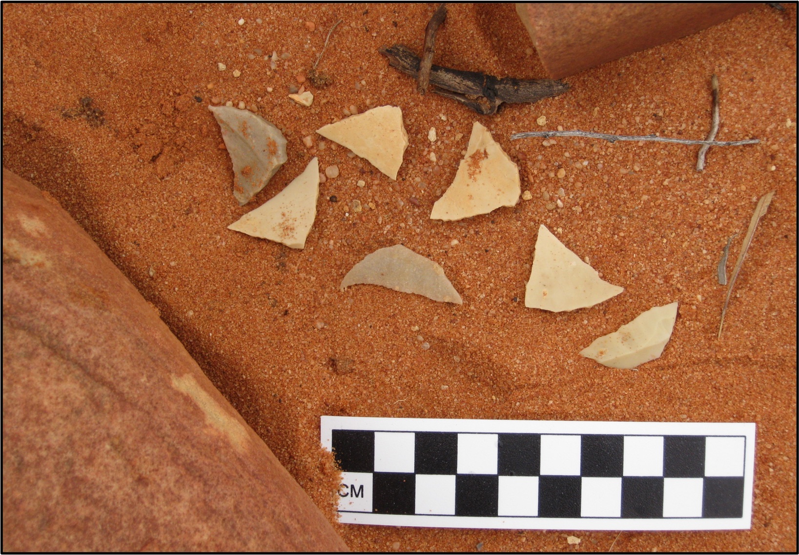
(Fig. 4) Image: Peter Hiscock. Our habitat suitability model is testable with archaeological field data derived from stone artefact assemblage attributes.
Implications for Deep Time Archaeology
The Western Desert is clearly an arid place today, but it was even drier during the Last Glacial Maximum. This implies that the massive areas of low-ranked foraging habitats would have been even more inhospitable to ancient desert foragers c. 21,000 years ago. Unless profoundly different economic strategies were being employed in the Pleistocene, we expect that impoverished regions would have been only rarely visited since the last glacial cycle, even though adjacent desert areas may have supported regular or at least sporadic visitation.
Future Outcomes
Our research shows that we can gain a new perspective of the Western Desert’s Aboriginal past by adopting a more complex and realistic spatial assessment of the environment. Our findings highlight how future models of precontact forager land use can be integrated with Earth Observation data in order to better comprehend the environmental diversity and fine scale of resource variability in Australia’s vast and remote desert regions.
We hope our research will assist with fostering in a new era of field research in partnership with Indigenous communities to provide further understanding of the archaeological record and the industrious, versatile and resilient Aboriginal peoples of the Western Desert.
Post by Dr W. Boone Law, geospatial scientist and archaeologist at University of Adelaide’s Environment Institute.
Read the press release in the News.