BLOGS WEBSITE
TAG: mapping

Improved mapping of South Australia’s seagrass will help future recovery
Researchers at the University of Adelaide have been mapping large-scale seagrass cover and genus distribution on South Australia’s temperate coast. Seagrasses are environmentally and economically important. They provide ecosystem services for humans including the provision of habitat for commercial species, protection of infrastructure from erosion and sea level rise, and improved water quality through nutrient […]
Comments Off on Improved mapping of South Australia’s seagrass will help future recovery
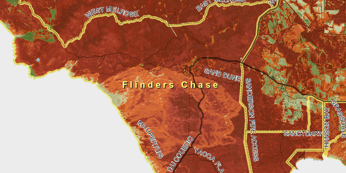
PHD student using satellite imagery to show burn impacts on Kangaroo Island
An early summer of unprecedented heat with lack of rain has led to devastating fires on Kangaroo Island. Boone Law, a PhD student for the Spatial Sciences program in the Environment Institute, has deviated away from his usual studies to focus on mapping the bushfire burn areas on Kangaroon Island, South Australia. He has been […]
Comments Off on PHD student using satellite imagery to show burn impacts on Kangaroo Island