BLOGS WEBSITE
TAG: Boone Law
University of Adelaide researchers raise awareness on the importance of satellite imagery for mapping bushfire impacts
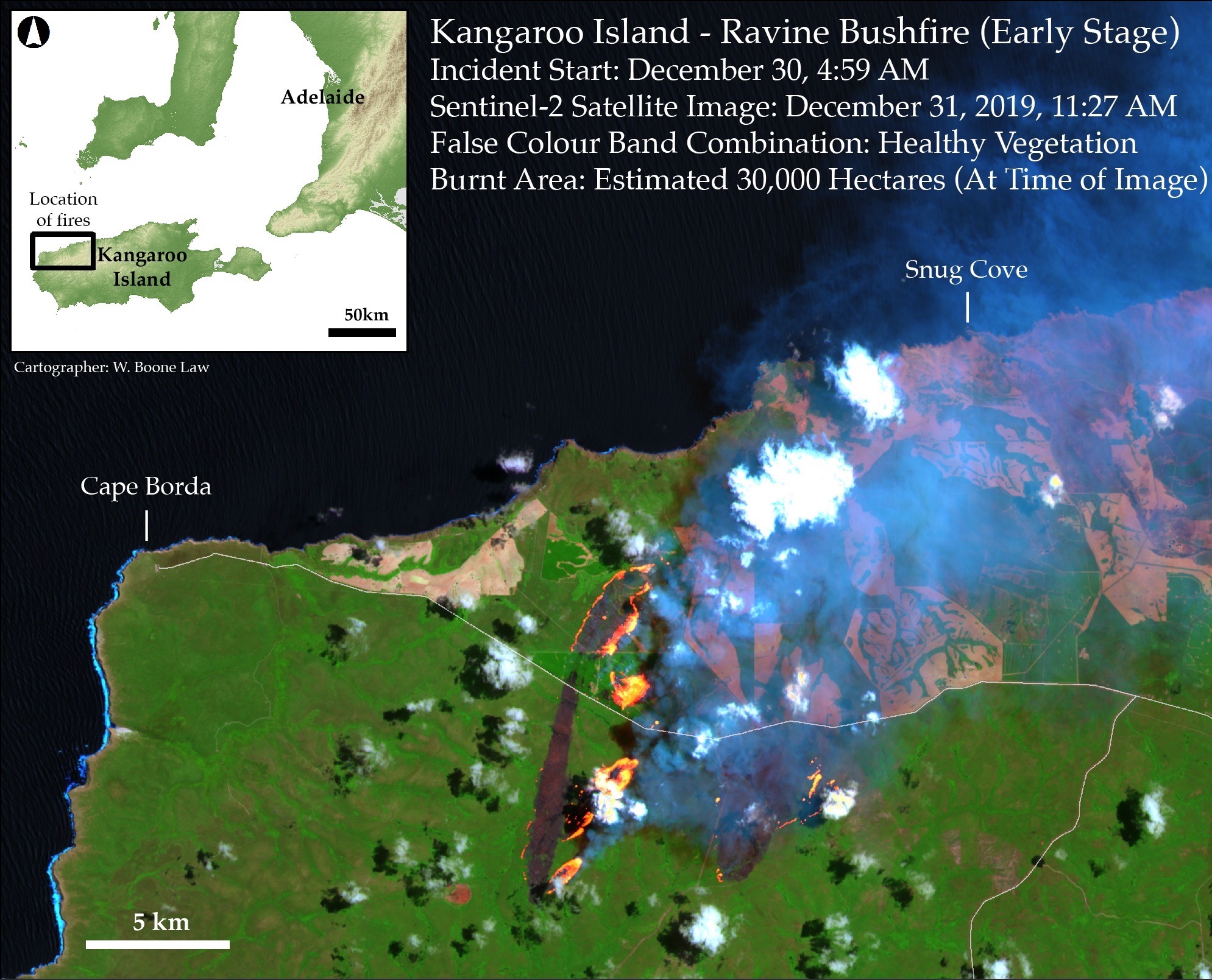
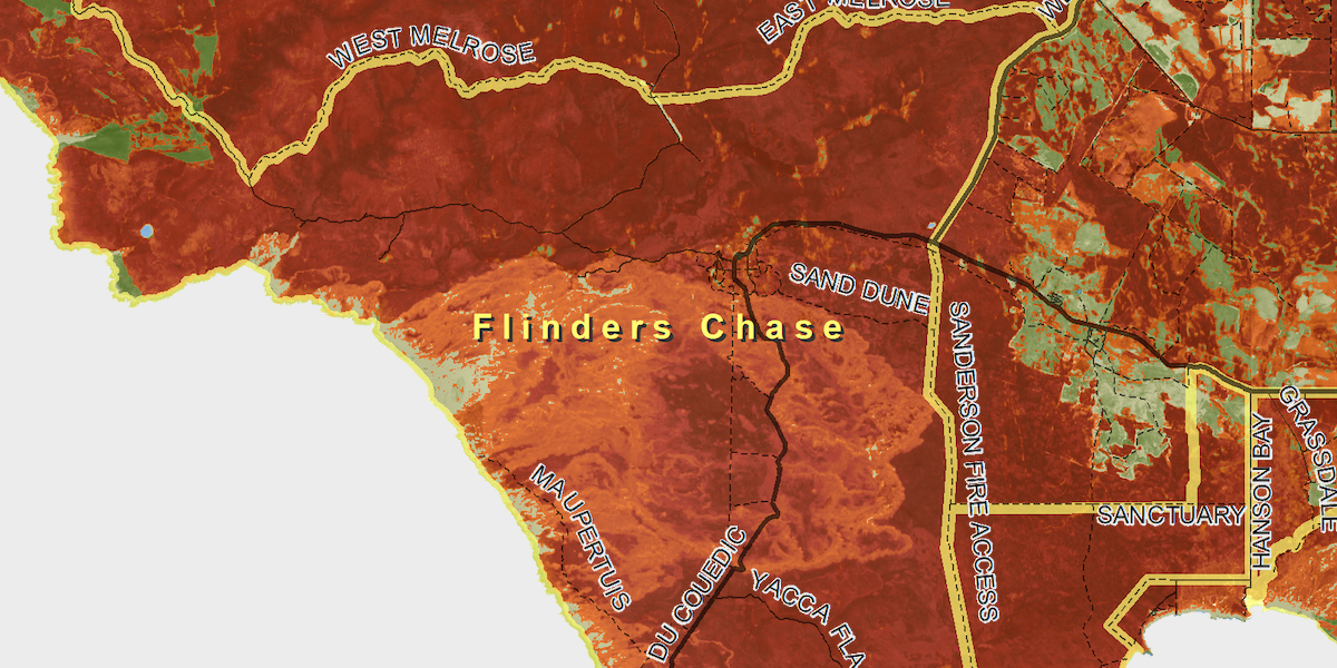
The Conversation features lessons learnt by Boone Law as he mapped bushfire impacted areas on Kangaroo Island. By PhD candidate Wallace Boone Law with contributions from Megan M. Lewis. My recent experience suggests there is a considerable knowledge gap between ‘Big Satellite Data’ and ‘those who need it’. Megan and I share the concern that neither the general public […]
Comments Off on University of Adelaide researchers raise awareness on the importance of satellite imagery for mapping bushfire impacts
PHD student using satellite imagery to show burn impacts on Kangaroo Island
An early summer of unprecedented heat with lack of rain has led to devastating fires on Kangaroo Island. Boone Law, a PhD student for the Spatial Sciences program in the Environment Institute, has deviated away from his usual studies to focus on mapping the bushfire burn areas on Kangaroon Island, South Australia. He has been […]
Comments Off on PHD student using satellite imagery to show burn impacts on Kangaroo Island