BLOGS WEBSITE
Category: Spatial Science Research Group
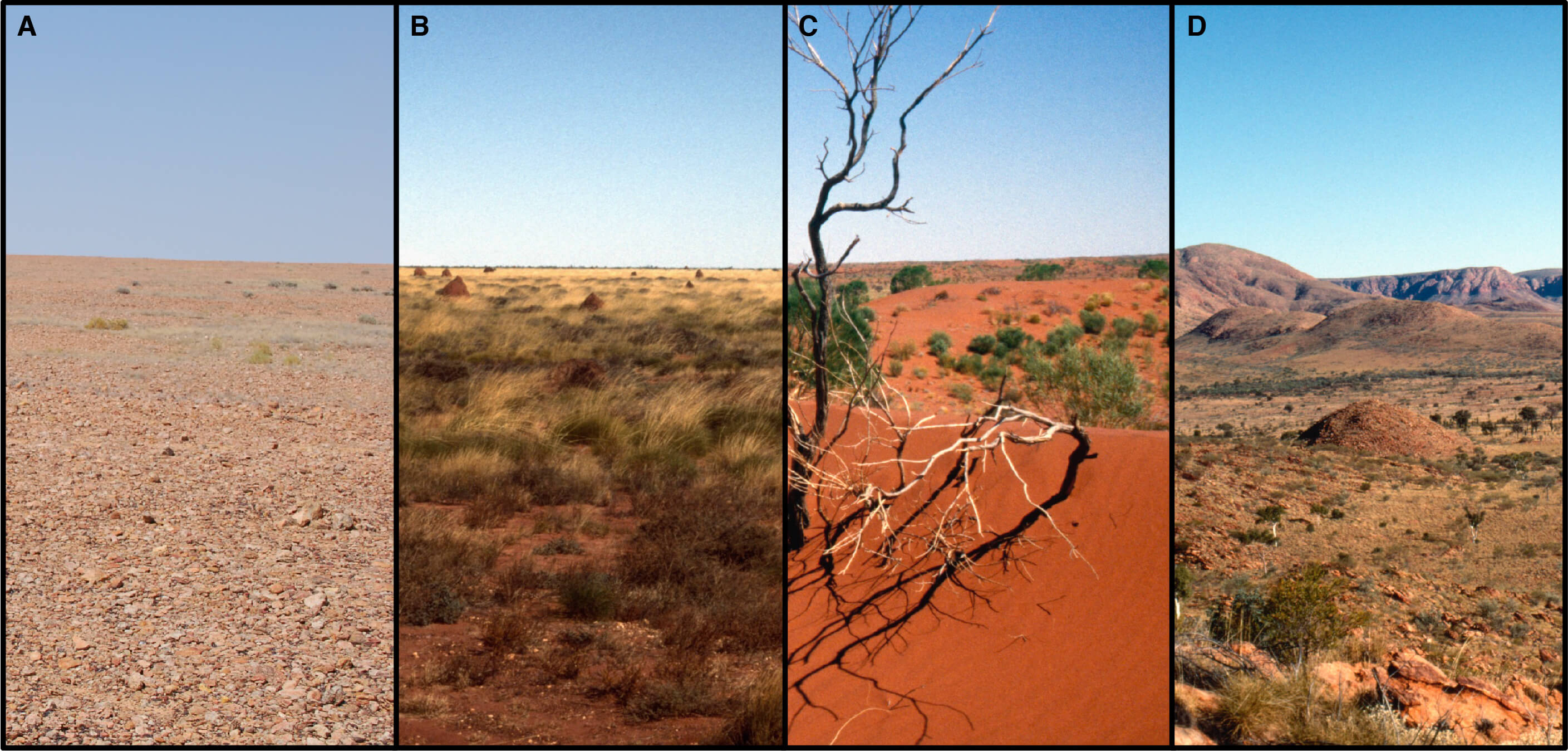
Satellite Imaging Offers New Insights of Western Desert Ecology and Precontact Aboriginal Land Use
The ‘Western Desert’, as it is commonly known, is one of the most arid and geographically remote regions of Australia. It expands across roughly 14.0% of the continent, encapsulating nearly 1.1 million km2 in total. Rainfall, which averages less than 250 mm annually, is seasonally unreliable and ambient temperatures exceed 35°C more than 114 days out […]
Comments Off on Satellite Imaging Offers New Insights of Western Desert Ecology and Precontact Aboriginal Land Use
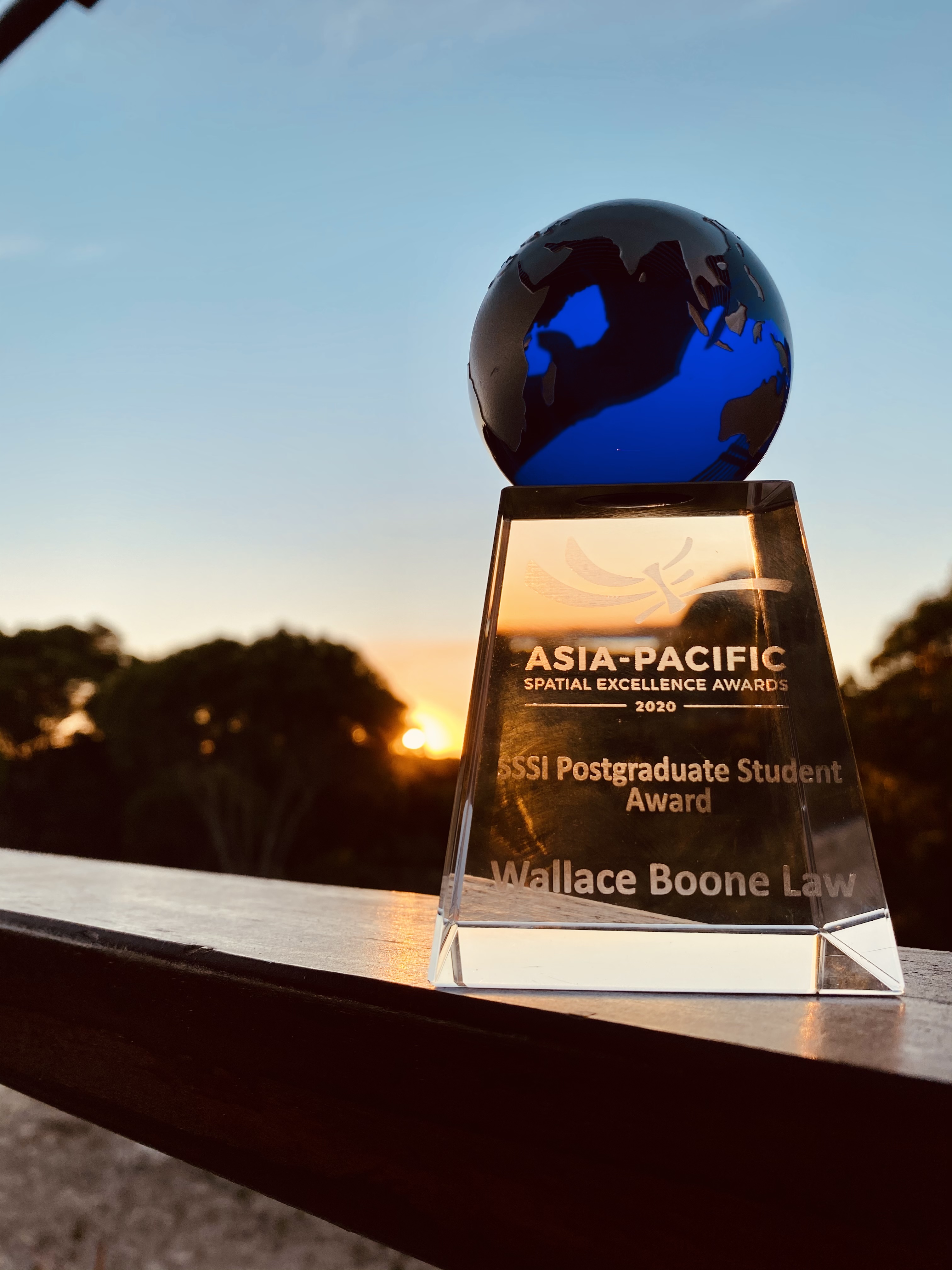
Researcher receives Oceanic-Region recognition at the Asia-Pacific Spatial Excellence Awards
Dr. W. Boone Law, has been internationally recognised as a joint recipient of the Oceanic-region Postgraduate Student Award at the Asia-Pacific Spatial Excellence Awards (APSEA). The APSEA awards are the only professional awards for the Asia-Pacific region that recognise the excellent achievement of individuals and organisations engaged in the surveying and spatial information industry. This […]
Comments Off on Researcher receives Oceanic-Region recognition at the Asia-Pacific Spatial Excellence Awards

Improved mapping of South Australia’s seagrass will help future recovery
Researchers at the University of Adelaide have been mapping large-scale seagrass cover and genus distribution on South Australia’s temperate coast. Seagrasses are environmentally and economically important. They provide ecosystem services for humans including the provision of habitat for commercial species, protection of infrastructure from erosion and sea level rise, and improved water quality through nutrient […]
Comments Off on Improved mapping of South Australia’s seagrass will help future recovery
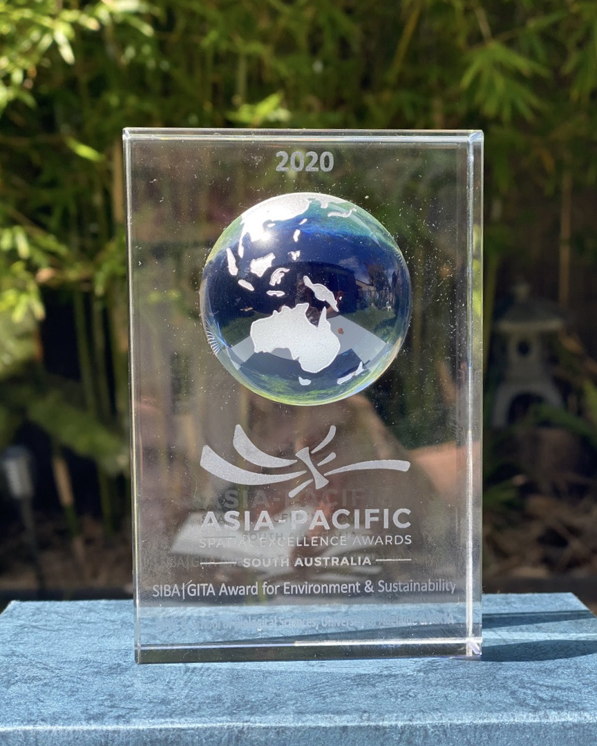
University of Adelaide Spatial Scientists Receive Top Awards
Australia’s peak body representing surveying and spatial science professionals, has recently recognised the work of two University of Adelaide researchers. The Surveying and Spatial Sciences Institute (SSSI) recently awarded Dr. Ken Clarke and Dr. W. Boone Law with top honours at the regional (SA) Asia-Pacific Spatial Excellence Awards (APSEA) ceremony, held at the Adelaide Pavilion […]
Comments Off on University of Adelaide Spatial Scientists Receive Top Awards
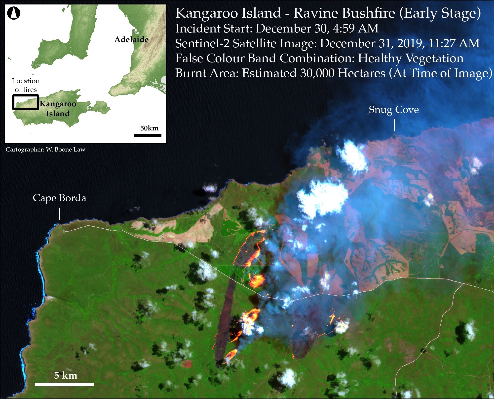
University of Adelaide researchers raise awareness on the importance of satellite imagery for mapping bushfire impacts
The Conversation features lessons learnt by Boone Law as he mapped bushfire impacted areas on Kangaroo Island. By PhD candidate Wallace Boone Law with contributions from Megan M. Lewis. My recent experience suggests there is a considerable knowledge gap between ‘Big Satellite Data’ and ‘those who need it’. Megan and I share the concern that neither the general public […]
Comments Off on University of Adelaide researchers raise awareness on the importance of satellite imagery for mapping bushfire impacts
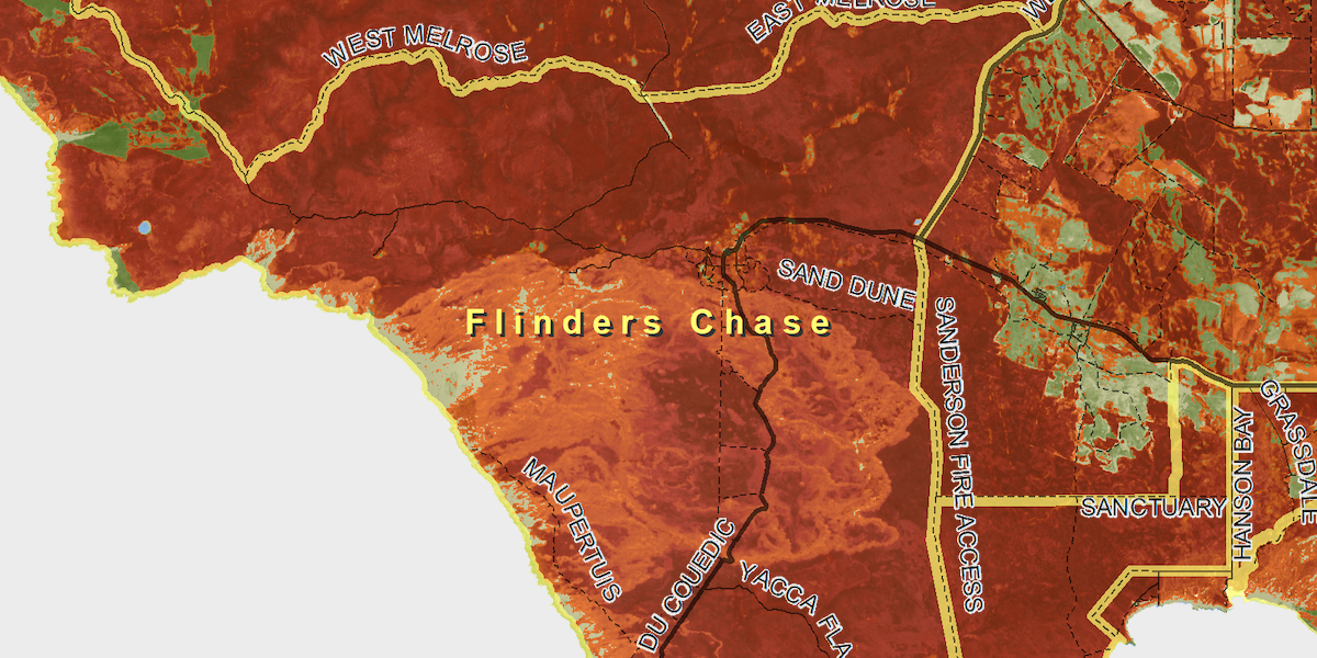
PHD student using satellite imagery to show burn impacts on Kangaroo Island
An early summer of unprecedented heat with lack of rain has led to devastating fires on Kangaroo Island. Boone Law, a PhD student for the Spatial Sciences program in the Environment Institute, has deviated away from his usual studies to focus on mapping the bushfire burn areas on Kangaroon Island, South Australia. He has been […]
Comments Off on PHD student using satellite imagery to show burn impacts on Kangaroo Island